
Potter Township, Centre County, Pennsylvania
Potter Township, Centre County, Pennsylvania | |
|---|---|
Township | |
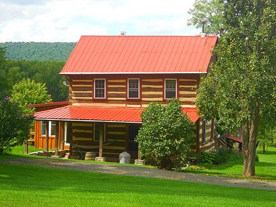
 A farm along Pennsylvania Route 192 just East of Centre Hall | |
 Map of Centre County, Pennsylvania highlighting Potter Township | |
 Map of Centre County, Pennsylvania | |
| Country | United States |
| State | Pennsylvania |
| County | Centre |
| Settled | 1767 |
| Incorporated | 1774 |
| Government | |
| • Type | Board of Supervisors |
| • Chairman | Tom Sharer |
| • Vice-chairman | Jake Tanis |
| • Supervisor | Robert Corman |
| • Supervisor | Dick Decker |
| • Supervisor | Ron Sweitzer |
| Area | |
| • Total | 58.98 sq mi (152.77 km2) |
| • Land | 58.86 sq mi (152.44 km2) |
| • Water | 0.13 sq mi (0.33 km2) |
| Population | |
| • Total | 3,614 |
| • Estimate (2021)[2] | 3,586 |
| • Density | 60.50/sq mi (23.36/km2) |
| ZIP code | 16875 |
| Area code | 814 |
| FIPS code | 42-027-62360 |
| Website | pottertownship |
Potter Township is a township in Centre County, Pennsylvania, United States. It is part of Penns Valley and the State College, Pennsylvania Metropolitan Statistical Area. The population was 3,614 at the 2020 census.[2] Communities in Potter Township include Black Hawk, Colyer, Fruittown, Old Fort, Potter Mills, Red Mill, and Tusseyville.
History
[edit]Indigenous Peoples
[edit]The first inhabitants of Potter Township came towards the end of the last glacial period. They lived a nomadic hunter-gatherer lifestyle for thousands of years.[3] The Delaware, Iroquois, Mingo, and Shawnee were among the native inhabitants who began establishing settlements, farms, and trails throughout the surrounding valleys and water gaps.[4]
Many of the trails paved by Native Americans are now major roads and highways, including the Kishacoquillas Path, named after a Shawnee chief. The path traversed from present-day Milesburg to Lewistown passing through Old Fort, Potter Mills, and over the Seven Mountains. The path is now Pennsylvania Route 144.[4]
European settlements
[edit]In 1764, using trails established by Native Americans, James Potter, a general and politician from County Tyrone, Ireland, led the first recorded expedition of present-day Centre County, which was part of the frontier that separated the colonists from Indigenous communities.[5]
In 1774 Potter built a log home in the area. In 1777 Potter established Potter Fort (now known as Old Fort) by building a stockade surrounding his home and the nearby spring.[6]
Iroquoian warriors began raiding illegal European settlements resulting in the Big Runaway in the summer of 1778. Two American soldiers were killed in these raids a mile east of Old Fort.[7] Settlers in Penns Valley fled to Fort Augusta at Sunbury alongside other settlers near the West Branch Susquehanna River.[3]
The Potter family established Potter Mills along the banks of Sinking Creek. By 1817 the hamlet had five mills.[6] By 1874 Potters Mills had 48 residents,[4] it has since grown to a population of 263.[8]
William Colyer built a sawmill near Tussey Mountain providing lumber for the nearby communities and fueling the local iron furnaces. A post office and general store were built to serve the community now known as Colyer. In the 1960s a dam was built on Sinking Creek by the Pennsylvania Fish Commission creating Colyer Lake.[7]
Present
[edit]Potter Township hosts the Grange Encampment and Fair garnering over 200,000 visitors, 1,000 tents, and 1,500 RV's, bringing in $2.6 million in 2017. The fair began as a picnic in 1874 organized by Leonard Rhone to inform other grangers of the Order of Patrons of Husbandry.[9]
Leonard Rhone's historic homestead now hosts Rhoneymeade Arboretum and Sculpture Garden, in 1986 the homestead became the first property to be permanently conserved by the ClearWater Conservancy.[10]
During a press conference in 2019 Gov. Tom Wolf announced that the state would fund a project to replace or upgrade a section of Route 322 between Potter Mills and the Mount Nittany Expressway.[11][12] The project came under scrutiny because the plan could cost upwards of $800 million and would damage or destroy wetlands, farmlands, soils, historic sites, homes, creeks, and other habitats. Many families have pitched signs alongside Route 322 in protest.[13][14]
Located in Potter Township are the following sites on the National Register of Historic Places: Andrew Gregg Homestead, Egg Hill Church, Maj. John Neff Homestead, Neff Round Barn, Leonard Rhone House, Potter-Allison Farm, and Daniel Waggoner Log House and Barn.
Geography
[edit]According to the United States Census Bureau, the township has a total area of 59.0 square miles (152.8 km2), of which 58.8 square miles (152.4 km2) is land and 0.12 square miles (0.3 km2), or 0.22%, is water.[15]
Potter Township is bordered by Benner, Spring and Walker townships to the north, Gregg Township to the east, Mifflin and Huntingdon counties to the south, and Harris Township to the west. The township also surrounds the separate borough of Centre Hall and is part of the Penns Valley region of Centre County.
The area in the valley south of Nittany Mountain is known as "The Great Plains", "The Plains", and "Potter Plains". Reverend Philip Vickers Fithian, who stayed at James Potter's home, wrote a detailed account of his experience in Penns Valley. He described The Great Plains as such:
... in this Valley (Penns Valley) are large open Plains. cleared either by the Indians, or by accidental Fire, hundreds of Acres covered with fine grass, mixed with small Weed and great Variety of Flowers ...[16]
Penn's Prairie at Tri-Municipal Park in Potter Township is jointly owned by Potter Township and Centre Hall. Half of the 165-acre park is dedicated towards plant and wildlife restoration, conservation and a cultural rejuvenation of The Great Plains.[17]
Demographics
[edit]| Census | Pop. | Note | %± |
|---|---|---|---|
| 2000 | 3,339 | — | |
| 2010 | 3,517 | 5.3% | |
| 2020 | 3,614 | 2.8% | |
| 2021 (est.) | 3,586 | [2] | −0.8% |
| U.S. Decennial Census[18] | |||
As of the census[19] of 2000, there were 3,339 people, 1,267 households, and 952 families residing in the township. The population density was 57.5 inhabitants per square mile (22.2/km2). There were 1,467 housing units at an average density of 25.2/sq mi (9.7/km2). The racial makeup of the township was 98.71% White, 0.39% African American, 0.15% Native American, 0.18% Asian, 0.03% Pacific Islander, 0.21% from other races, and 0.33% from two or more races. Hispanic or Latino of any race were 0.45% of the population.
There were 1,267 households, out of which 31.3% had children under the age of 18 living with them, 65.8% were married couples living together, 5.9% had a female householder with no husband present, and 24.8% were non-families. 20.4% of all households were made up of individuals, and 8.3% had someone living alone who was 65 years of age or older. The average household size was 2.54 and the average family size was 2.94.
In the township the population was spread out, with 26.0% under the age of 18, 6.1% from 18 to 24, 29.0% from 25 to 44, 27.3% from 45 to 64, and 11.7% who were 65 years of age or older. The median age was 39 years. For every 100 females, there were 98.5 males. For every 100 females age 18 and over, there were 100.7 males.
The median income for a household in the township was $43,556, and the median income for a family was $50,000. Males had a median income of $36,571 versus $23,781 for females. The per capita income for the township was $21,320. About 7.0% of families and 8.1% of the population were below the poverty line, including 8.4% of those under age 18 and 8.2% of those age 65 or over.
-
 Plum Grove Manor on Manor Road
 -
 Standford house


References
[edit]- ^ "2016 U.S. Gazetteer Files". United States Census Bureau. Retrieved August 13, 2017.
- ^ a b c d "City and Town Population Totals: 2020—2021". Census.gov. US Census Bureau. Retrieved August 13, 2022.
- ^ a b "Those Who Came Before: The Archaeology of Centre County's Native Americans". Centre County Historical Society. March 23, 2022.
- ^ a b c "A Journey to Potter Mills". The Pennsylvania Department of Transportation. August 9, 2021.
- ^ Macneal, Douglas (December 2016). "Centre County Overview". Centre County Historical Society.
- ^ a b Maris, Matt (May 26, 2024). "The ABCs of Centre County". StateCollege.com.
- ^ a b "Celebrating 250 Years in Potter Township". Centre County Historical Society.
- ^ "Census Population API". United States Census Bureau. Retrieved October 16, 2022.
- ^ "Proclamation 23 of 2018 - Grange Fair Days". August 14, 2018.
- ^ Andrea, Murrell (July 1, 2022). "Get your daily dose of awe at Centre Hall's Rhoneymeade Arboretum and Sculpture Garden". Centre Daily Times.
- ^ Pallotto, Brett (April 4, 2022). "A PA project could cost $800M and improve safety. Centre County residents fear what it'd destroy". Centre Daily Times.
- ^ Braff, Douglas (September 16, 2022). "State College Connector Project narrows potential routes to three options". wjactv.
- ^ Danahy, Anne (September 12, 2022). "PennDOT asks public to 'save the date' for October meetings on U.S. Route 322 connector project in Centre County". WPSU Public Media for Central Pennsylvania.
- ^ Gruber, Philip (August 15, 2023). "Road to Ruin: Route 322 Widening Could Devastate Family's Centre County Farm". Lancaster Farming.
- ^ "Geographic Identifiers: 2010 Census Summary File 1 (G001): Potter township, Centre County, Pennsylvania". U.S. Census Bureau, American Factfinder. Archived from the original on April 10, 2015. Retrieved April 10, 2015.
- ^ Melander, Jackie. "Penns-Brush-Valley Nomination email" (PDF). Centre County Historical Society.
- ^ "Penn's Prairie".
- ^ "Census of Population and Housing". Census.gov. Retrieved June 4, 2016.
- ^ "U.S. Census website". United States Census Bureau. Retrieved January 31, 2008.
